The History of Sint Maarten - Saint Martin
Few islands this small have had a history this complicated. Sint Maarten has been French, Dutch, Spanish, and English at various points — sometimes two at once — before arriving at its current arrangement: a single island, 37 square miles, divided between two sovereign nations with no border controls between them. Understanding how that happened explains a great deal about why the island is the way it is today.
Salt and the first settlers
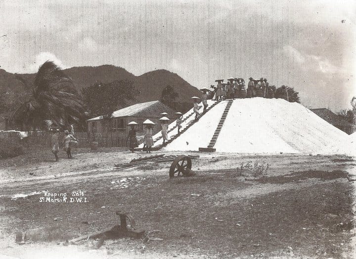
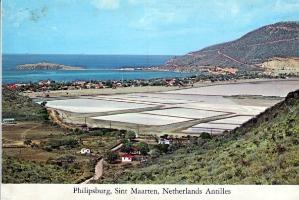
The Dutch did not come to Sint Maarten for the beaches. They came for the salt.
In the 16th century, salt was industrial infrastructure — the only reliable way to preserve fish at scale across northern Europe. When the Dutch broke from Spain and lost access to Portugal's salt deposits, they needed a new source urgently. The island's numerous salt ponds made it an obvious target.
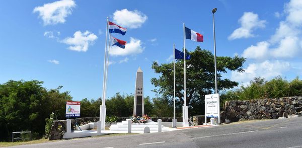
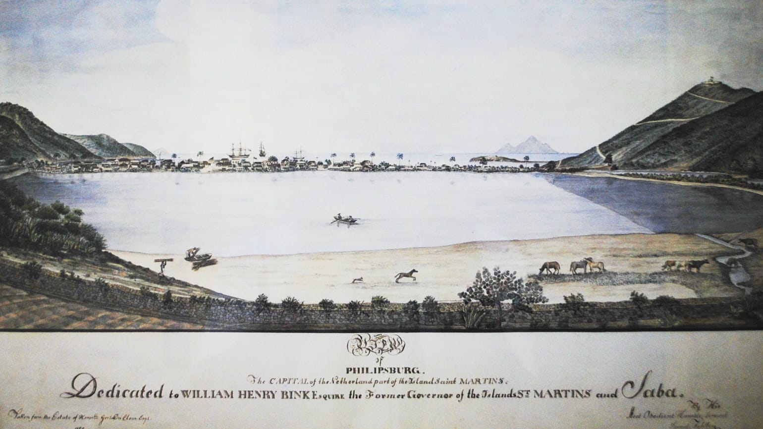
The Dutch established a settlement in 1631, though they arrived to find 14 French families already living there. Two years later the Spanish invaded and pushed both groups out. The French and Dutch retreated and waited. When the Spanish finally departed in 1648, the two powers negotiated a division of the island — formalized in the Treaty of Concordia, signed March 23rd, 1648.
The story of exactly how the border was drawn has been embellished ever since into what islanders call the Border Legend, which is worth reading on its own.
Even after the treaty, the island changed hands 16 more times — French, Dutch, and English powers all competing for control — before the partition was finally enforced in 1817, giving France 21 square miles and the Netherlands 16.
The plantation era and the slave trade
Sugar followed salt. From 1648 onward, plantation agriculture came to define the island's economy, built entirely on enslaved labor. The slave trade shaped Sint Maarten for 220 years until abolition in 1848.
With abolition, the plantations collapsed. The island fell back on salt. By 1850, more than 330,000 barrels were being produced annually and a third of the population worked the ponds. The industry sustained the island for another century before declining after the 1920s and shutting down entirely in 1949.
World War II and the airport
By the 1940s, Sint Maarten's population had fallen to around 2,000 — half what it had been a generation earlier. The plantations were gone, the salt industry was dying, and the isolation imposed by two world wars had ground the economy to near-nothing.
Then the war came directly to the island's waters.
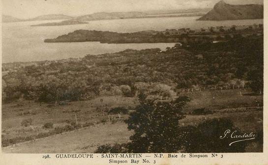
German U-boats operated throughout the Caribbean during World War II, threatening Allied shipping lanes. The French side of the island, under Vichy France, was collaborating with Germany — and the uninhabited island of Tintamarre, just off the French coast, served as a provisioning base for German submarines. The ruins of those docks are still visible on Tintamarre today.
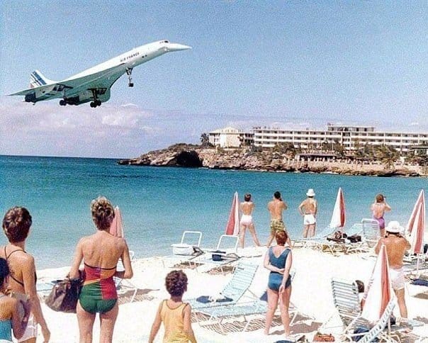
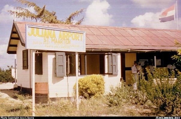
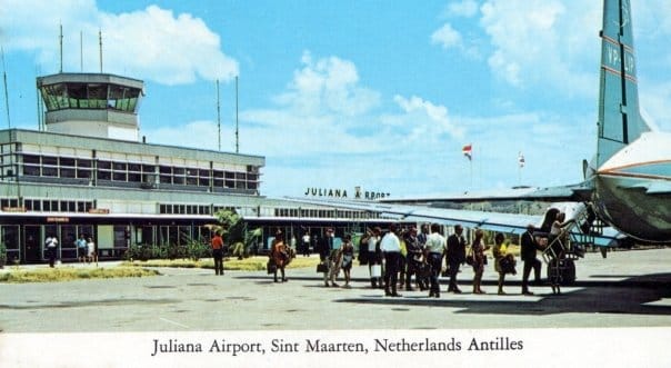
The Americans, tasked with hunting the U-boats from the air, needed airstrips across the region. In 1943 they built one on the Dutch side of Sint Maarten. That military airstrip became Princess Juliana International Airport — the gateway that made modern tourism possible, built specifically to pursue the submarines being resupplied a few miles away on the French side.
Rémy de Haenen and the Tintamarre airline
After the war, a Belgian adventurer named Rémy de Haenen got his pilot's license in Miami and flew immediately to the Caribbean. In 1946 he founded the Compagnie Aérienne Antillaise and based it on Tintamarre — the same uninhabited island the submarines had used. His fleet was American military surplus. His co-pilots were former RAF men. They flew without insurance, connecting islands that had no other air service, with passengers holding the cabin doors shut mid-flight.
Three fatal accidents and a hurricane ended the airline in 1950. Tintamarre returned to nature.
De Haenen went on to become Mayor of St. Barths, join the Cousteau expedition hunting for Spanish galleons, and found Eden Rock — now one of the Caribbean's most celebrated hotels. The airport at St. Barths bears his name. He died in 2008, aged 91.
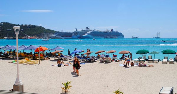
Tourism
The duty-free status established in 1939 combined with the new airport to create the conditions for a tourism economy. By 1965 the population had rebounded to 4,000. By the mid-1980s, 40,000 people lived on the island — a near-complete transformation within a single generation.
Hurricanes
Sint Maarten has been shaped by storms as much as by any political decision. Hurricane Luis in 1995 caused catastrophic damage. Hurricane Lenny struck again in 1999 before the island had fully recovered. Hurricane Irma in September 2017 was the worst in living memory — approximately 90% of buildings were damaged or destroyed. Each time, the island rebuilt.
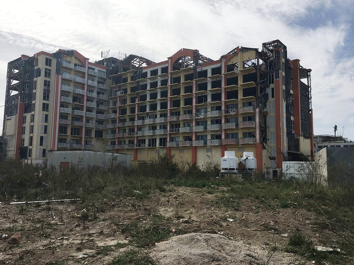
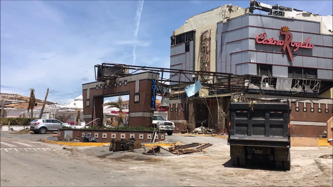
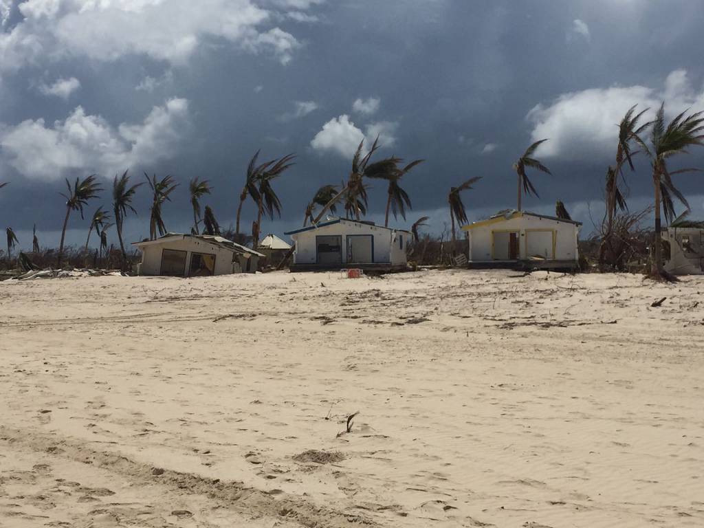
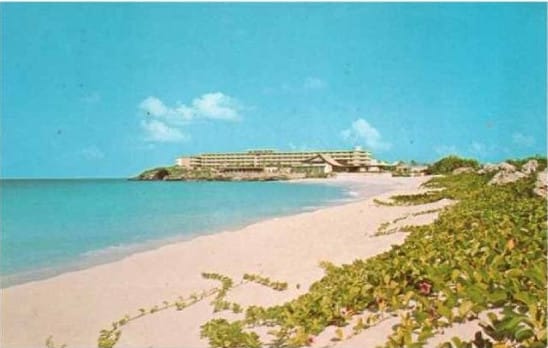
Picture 1 is the Sonesta Maho, Picture 2 is Maho Village and Picture 3 is Club Orient
Independence: 10-10-10
On October 10th, 2010 — 10-10-10 — the Dutch side of the island became a separate autonomous country within the Kingdom of the Netherlands. The Netherlands Antilles, the federation that had governed the Dutch Caribbean territories since 1954, was dissolved. Sint Maarten now governs itself, with King Willem-Alexander as head of state, making it one of the smallest countries in the world by both territory and electorate.
The French side had already moved in 2007, when Saint-Martin became a Collectivité d'outre-mer — separating from Guadeloupe and gaining its own representation in Paris.
Two nations. One island. No border.